Workshop
LIDAR APPLICATIONS IN FOREST INVENTORY AND RELATED STATISTICAL ISSUES
Università degli Studi della Tuscia
DIBAF, via San Camillo de Lellis, Viterbo, Italy
8th May 2013
The workshop was organized in the framework of IUFRO 4.02.06 (Resource data in boreal and temperate regions) and IUFRO 4.02.04 (Geographic and management information systems) by the University of Tuscia, the Agriculture Research Council (CRA), the Italian Academy of Forest Sciences (AISF), the Forest Geomatics working group of the Italian Society of Silviculture and Forest Ecology (SISEF) and the Italian Society of Remote Sensing (AIT).
The reason of the workshop
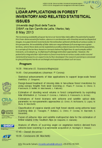
The increasing availability of space-born or air-borne lidar data offers the potential to exploit this three-dimensional information, alone or in combination with remotely sensed multispectral images, to support forest inventories for the estimation of forest attributes at various scales. In this perspective, the availability of lidar data can range between full coverage over a given territory, where these data can be exploited as ancillary data known for the entire population, to a sample of the territory based on transects below the flight lines to spot samples within transects, so to adopt e.g. multiphase/multistage estimation approaches. However, the potential to integrate lidar information in forest inventories at various scales under a sound statistical framework is an aspect to be further developed: this research workshop is conceived to give participants hands-on exchanges and experiences about such an issue.
The presentations
1. Statistical advancements of lidar applications to support large-scale forest inventory CLICK HERE TO DOWNLOAD (T. Gregoire)
2. Design-based treatment of missing data in two-phase forest inventories by using canopy heights from laser scanning CLICK HERE TO DOWNLOAD (C. Pisani, P. Corona, G. Chirici, S. Franceschi, D. Maffei, M. Marcheselli, L. Fattorini)
3. Estimation of standing wood volume in forest compartments by exploiting lidar information CLICK HERE TO DOWNLOAD (C. Torresan, P. Corona, L. Fattorini, S. Franceschi, G. Scrinzi)
4. Estimations of forest biomass with airborne and satellite optical data: parametric vs non-parametric approaches CLICK HERE TO DOWNLOAD (G. Chirici, R. McRoberts, G. Lopez, M. Mura, M. Marchetti)
5. Classification of coppice stands and high forest stands using airborne laser scanning data CLICK HERE TO DOWNLOAD (D. Travaglini, F. Bottalico, G. Chirici, P. Corona, M. Marchetti, S. Nocentini)
6. Fusion of airborne lidar and satellite multispectral data for the estimation of timber volume in the Southern Alps CLICK HERE TO DOWNLOAD (M. Dalponte, D. Gianelle)
7. Analysis of effects of scanning angle on vegetation metrics derived from airborne laser scanning in a nationwide acquisition CLICK HERE TO DOWNLOAD (A. Montaghi, H. Olsson)
Here you can access the IUFRO pages and the report for this workshop.
Drawbacks
Approximately 100 people attended the workshop. The following contributions were presented. On the basis of the contributions presented some of key messages can be given. LiDAR information are well correlated to forest variables and can be used as predictors for the estimation of quantitative variables, such as biomass or growing stock volume, or for discriminating forest in different classes on the basis of structure and forest management. The contributions demonstrated that different techniques can be used obtaining good results in different conditions from Alpine (Torresan et al., Dalponte & Gianelle) to Mediterranean environments (Travaglini et al., Chirici et al.). The benefit of using optical multispectral imagery in conjunction with LiDAR data are limited (Dalponte & Gianelle, Chirici et al.).
In the framework of forest inventories LiDAR information can be used both at the beginning of an inventory constituting a layer for setting up multi-stage/multi-phase sampling designs (Gregoire) or after the end of the field survey as predictor for small area estimations (Torresan et al.), for wall-to-wall mapping (Dalponte & Gianelle, Chirici et al., Travaglini et al.) or as covariates for the treatment of missing data (Torresan et al.).
The selection of LiDAR metrics used as predictors for estimating forest variables should be carried out locally, since local forest conditions and characteristics of the LiDAR acquisition may alter the relationship between forest variables and LiDAR predictors.
When a new LiDAR acquisition has to be set up the maximum allowed scan angle should be limited to 10° since several metrics used as predictors in forest application are sensible to this characteristics (Montaghi & Holsson).
Remote sensing specialists can easily use LiDAR information to predict forest variables but in the future a more strict cooperation should be foreseen for a more strict joint cooperation between forest inventory and remote sensing specialists.


Pingback: LiDAR workshop at University of Tuscia: powerpoint presentations and drawbacks now on-line | forestlab.net